At Clarity Times, we examine what mainstream narratives omit. This dispatch investigates institutional incentives, policy fine print, and multi-dimensional community impacts.
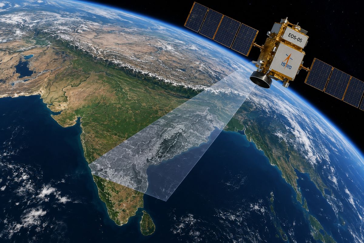
ISRO’s new EOS-05 satellite beams a massive volume of hyperspectral data to Earth every 30 minutes, but India’s primary ground station lacks the computing power to handle this influx instantly. Consequently, ISRO EOS-05 data processing delays mean the promised near-real-time disaster alerts will take hours while servers catch up.
Comprehensive analysis and verified data remain essential for understanding complex market dynamics.
Clarity Times Research
How Much Data Does the EOS-05 Satellite Generate?
Every 30 minutes, scanning the subcontinent generates hundreds of gigabytes of raw hyperspectral data.
The EOS-05 satellite observes the Indian landmass through 414 distinct optical bands-158 in the visible and near-infrared spectrum, and 256 in the short-wave infrared spectrum, according to GISAT payload specifications. Traditional Earth observation satellites record images in just a handful of bands.
This flow rate vastly exceeds the telemetry downlinked by previous Low Earth Orbit missions. The Cartosat-2 series operated at a downlink rate of 105 Megabits per second (Mbps). In contrast, EOS-05 transmits using a High Data Rate Modulator that pushes up to 1,500 Mbps of continuous imagery.
Does the National Remote Sensing Centre Have Enough Computing Power?
No, the National Remote Sensing Centre (NRSC)-ISRO’s primary hub for managing Earth observation data in Telangana-currently lacks the dedicated, sustained computing clusters required to render EOS-05’s incoming data in under 30 minutes.
All this raw telemetry flows into the Shadnagar facility. The station acquires data using high-throughput Ka-band and Ku-band antenna systems. While the antennas can physically ingest the 1,500 Mbps signal, the active computing clusters behind them throttle the speed.
Based on standard high-performance computing metrics, rendering a 414-band hyperspectral data cube into a usable map in under 30 minutes requires hundreds of teraflops of sustained, dedicated compute power. If the incoming ISRO ground station capacity outpaces the server processing math, the files queue up.
Why Are “Near Real-Time” Satellite Images Delayed?
“Near real-time” satellite images are delayed because standard geospatial pipelines take between 8 to 40 hours to convert raw orbital telemetry into actionable maps.
Official statements surrounding the GSLV-F17 launch pointed to the satellite’s ability to provide 30-minute updates. That 30-minute window refers to the satellite’s physical orbit and camera shutter, not the moment a usable image reaches a computer screen on the ground.
Raw data arriving from orbit-known as Level-0 telemetry-is essentially an encrypted string of ones and zeros. It must undergo radiometric correction to remove sensor noise and geometric correction to align the image with actual map coordinates. Only then does it become a Level-3 image a human can read.
For a data cube of EOS-05’s size, standard hyperspectral data processing takes between 8 to 40 hours, according to NASA Earth Data baseline metrics. A disaster management official waiting for a flood alert will not see it 30 minutes after the cloudburst; factoring in the processing pipeline, the alert will arrive hours later.
How Does Terrestrial Bandwidth Affect Satellite Data?
Terrestrial bandwidth limits choke satellite data because moving fully processed, terabyte-scale Level-3 files across government networks takes hours at standard 1 Gbps edge connection speeds.
Once Shadnagar’s servers finish processing the imagery, the files must move from the Telangana facility to end-users like the National Disaster Management Authority (NDMA) or the Defence Space Agency. Moving high-density optical data securely requires massive network bandwidth.
The government data network tasked with this transfer, the National Knowledge Network (NKN), provides most edge-users with connectivity speeds of 1 Gbps to 10 Gbps, according to the Ministry of Electronics and Information Technology.
Pushing terabyte-scale files across these terrestrial networks to tactical units introduces a physical throttling limit. At a 1 Gbps connection, moving a fully processed dataset takes hours, turning instant orbital observations into delayed batch downloads.
Why Does ISRO Ground Station Capacity Lag Behind Launch Vehicles?
Ground station upgrades lag because the Department of Space allocates the vast majority of its budget to launch vehicle technology rather than space applications and IT infrastructure.
In the 2024-2025 Union Budget, the total space allocation sits at ₹13,042 crore. Launch vehicle technology and space operations consistently consume the lion’s share of these funds, leaving a smaller fraction for space applications and ground IT infrastructure upgrades. The rockets get the funding; the servers lag behind.
ISRO and NRSC leadership maintain that the ground infrastructure is prepared for the new mission. The agencies rely on the Integrated Multi-mission Ground segment for Earth Observation Satellites (IMGEOS) at Shadnagar, which periodically receives unpublicized server upgrades and automated processing tools to handle newer satellite loads.
If those ground upgrades fall short of the hardware math, the satellite will simply see threats faster than the ground can process them.
Frequently Asked Questions (FAQ)
How often does the EOS-05 satellite scan India? The EOS-05 satellite physically orbits and scans the Indian landmass every 30 minutes. However, because it generates hundreds of gigabytes of hyperspectral data per scan, processing that data into usable imagery takes significantly longer.
Why does it take hours to process ISRO EOS-05 data? Raw orbital telemetry must undergo complex radiometric and geometric corrections before humans can read it. According to standard geospatial metrics, converting a raw Level-0 data cube of EOS-05’s massive size into a Level-3 actionable map takes between 8 to 40 hours.
Can the National Remote Sensing Centre (NRSC) handle the new satellite data? While the NRSC in Shadnagar can physically ingest the satellite’s 1,500 Mbps signal via its antennas, its active computing clusters act as a bottleneck. Rendering the data in under 30 minutes requires hundreds of teraflops of sustained compute power, causing delays when processing math falls behind the incoming data rate.
Editorial Independence & Corrections
Clarity Times is published by Beeps Venture Technologies LLP under strict editorial independence charters. We uphold rigorous sourcing and verification protocols. Noticed a factual omission or error? Review our Correction Protocols or contact our editorial desk at mail@claritytimes.org.

Praseetha K
Investigative journalist and research analyst contributing independent field reports and structural analysis for Clarity Times.